Colorado mountains brace for heavy snow, dangerous travel conditions beginning Monday night
Colorado forecasters are predicting big powder days ahead, but some safety considerations for travelers on I-70

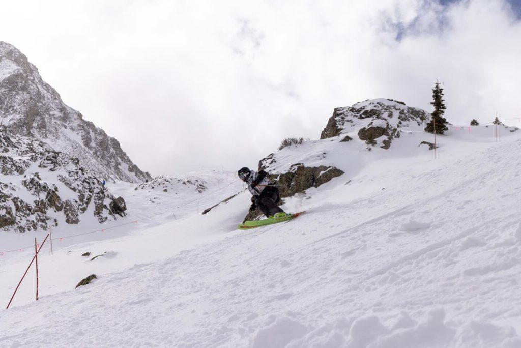
Courtesy photo
A two-part storm will be delivering significant snow to Colorado’s mountains beginning Monday night, with totals of up to 2 feet forecast for the central and southern mountains by Thursday. While the storm spells good news for ski resorts and the state’s record-low snowpack, meteorologists are warning of dangerous travel conditions.
Meteorologists with weather forecasting app OpenSnow are expecting “plenty of snow, multiple powder days, times of gusty/strong winds and rising avalanche risk,” according to a Monday report.
Colorado’s mountains are forecast to receive 2-6 inch snowfall beginning Tuesday morning, or as early as 4 a.m. After a mid-morning lull, another 2-6 inches of snowfall should return through the afternoon and evening, the report states.
West winds traveling between 25-35 miles per hour with gusts up to 50 miles per hour around some Western Slope mountains could lead to near zero visibility on roads, especially for travelers along I-70 from Rifle to Vail Pass and adjacent mountain corridors, according to a Tuesday wind advisory from the National Weather Service.
A separate winter storm advisory suggests possible accidents and closures from Monday night through Thursday morning, stating that travel “would be very difficult to impossible” due to the blowing snow reducing visibility to a quarter of a mile or less.
“If you must travel, keep an extra flashlight, food, warm clothes and water in your vehicle in case of an emergency,” the National Weather Service said in the advisory. Drivers are recommended to allow extra time during commutes and exercise caution when traveling through mountain passes.
Kris Sanders, a meteorologist with the National Weather Service, said roads conditions should improve slightly during the afternoon on most days, as warmer temperatures in the lower elevations ease some of the travel impacts from accumulating snowfall and flash freezes.
“There’s the potential for both (Tuesday and Wednesday) to have bad commutes in the morning, but, maybe, improve in the afternoon,” Sanders said. “As that front goes through, you could have those snow squall conditions during the rush hour, which isn’t good.”
Temperatures will be near 20 degrees across central and northern mountain resorts on Tuesday, while mountain towns will see temperatures in the 30s during the day.
After another 2-6 inches of accumulation on Tuesday night, a second piece of storm energy will move into Colorado on Wednesday, according to OpenSnow. This will trigger more steady snowfall throughout the day, with moments of “intense snow,” strong winds and an additional 2-6 inches of accumulation for several mountains.
Colorado’s central and southern mountains are expected to see the deepest snow totals. OpenSnow’s forecast for Wednesday states some of these mountains could see a snowfall rate of 1 inch per hour for parts of the day, totalling 5-10 inches just on Wednesday.
Another 2-6 inches of snow could accumulate through midnight on Wednesday, leading to soft powder conditions for resorts on Thursday morning. Wind speeds will also have mostly decreased by Thursday morning.
Thursday’s temperatures will be coldest for ski resorts, around 5-10 degrees. Most northern and central mountain towns will be near or above 20 degrees.
Snow totals
In total from Tuesday through Thursday, the central and southern mountains will see between 12-24 inches of snow from the storm, or up to 2 feet. Northern mountains will see slightly less snow, with a forecast range of 7-14 inches.
Because the wind direction will average from the west-southwest during part of the storm, southern mountains including Irwin, Crested Butte, Monarch and Snowmass will be heavily favored. Northeastern mountains around Summit County are often not favored by a west-southwest and southwest wind, according to OpenSnow.
The rest of the day on Thursday will be calmer. Friday and Saturday, on the other hand, could range from powder days to light showers.
More powder, more terrain
As the upcoming storm and more open terrain draws skiers out to the mountains, not all resorts will offer a smooth ride.
Ski resorts will likely see powder on Tuesday, according to OpenSnow, though the gusty winds could impact lift operations. Additional operational issues could be caused by low visibility and increased avalanche risk.
Snow will likely be softest on Thursday, after Wednesday night’s fresh snow lands on top of soft snow from the previous two days. For the best powder, head to the central mountains during the day on Wednesday or on Thursday morning.
Good news for Colorado’s snowpack… but barely
With proper, steady storms finally hitting Colorado’s mountains after months of drought and a record-low snowpack — which as of mid-February has been the lowest on record for this time of year — will 2 feet of snow finally lead to notable improvements?
Not quite, Sanders says.
“Relative to this winter, this is a significant storm. But in a normal winter, this is kind of run-of-the-mill,” Sanders said. “They will be an uptick, and maybe we’ll get ourselves out of the driest winter. But as far as making significant improvement, like getting out of the 10th percentile, that’s gonna be hard to do at this point.”
Sanders said that when it comes to the liquid content of the storm, very few locations will receive anything above an inch of snow water equivalent. Independence Pass, for example, would normally have around 12 inches of liquid around this time. Currently, it’s at around 5 inches.
“But every little bit counts,” Sanders said. “I think it will end up being (a low year) for the snowpack, it’s just how low.”
The next storm should hit Colorado around Feb. 25-28, according to OpenSnow. In the meantime, Saturday through Tuesday will be on the dry side. Sanders said the next month has the potential for a more active storm pattern compared to the first half of winter, though that could translate to rain for lower elevation towns due to higher-than-normal temperatures.
“We could make up some ground here in the last part of the winter … if the pattern stays like this, but it’s really hard once you get out past a month to see what’s going to happen,” Sanders said.


Support Local Journalism
Support Local Journalism
Readers around Craig and Moffat County make the Craig Press’ work possible. Your financial contribution supports our efforts to deliver quality, locally relevant journalism.
Now more than ever, your support is critical to help us keep our community informed about the evolving coronavirus pandemic and the impact it is having locally. Every contribution, however large or small, will make a difference.
Each donation will be used exclusively for the development and creation of increased news coverage.